GEDI in Zoonotic Surveillance – Governance Bridge between Earth Observation and One Health
Integrating Structural Visibility, Sensor Logic and Zoonotic Interfaces through a Cairo‑Based Scenario (and Icestorm in USA)
This topic matters deeply to me, which is why I also intend to publish this text in English, Chinese, Spanish, Arabic, French and Russian. If , any errors have inadvertently occurred during translation, I sincerely ask for your understanding — the translation was created with the help of an AI tool.
The framework is currently available exclusively in English.
Authorized translations may be undertaken following prior approval; the translation itself is the responsibility of the requesting institution or individual
- English
Zoonotic diseases do not emerge at random; they arise at interfaces — between species, across landscapes, along ecological and human movement corridors, and within the shifting boundary zones between visible and invisible processes. These interfaces are often spatially minute, temporally brief and functionally intricate, which raises a fundamental question: What role can global Earth observation systems play when the aim is to detect ecological changes that may create new points of contact relevant to zoonotic emergence?
The GEDI mission offers a structural perspective on vegetation and landscape, yet this perspective represents only a narrow slice of a much broader observational space. If zoonotic risks materialize at ecological edges, in microhabitats, along animal pathways or within fine transitional zones, it becomes essential to examine how far a large‑scale sensor can render such processes visible and where critical invisibilities arise that matter for biosurveillance and risk assessment.
This framework therefore positions itself as a governance‑oriented bridge between global structural measurements and the fine‑scale, dynamic, functional processes that underpin One Health. Rather than focusing solely on what GEDI shows, the framework interrogates the conditions under which GEDI reveals something, the contexts in which it reveals nothing, the reasons why certain structures become visible, and the implications of this visibility for understanding zoonotic emergence. This shifts attention toward the interplay of scale, sensor logic, data gaps, interpretive boundaries and uncertainty, and toward the question of how governance systems can make these interactions transparent, traceable and epistemically safe.

To translate these conceptual considerations into a concrete context, the framework employs a multi‑layered scenario based on the Greater Cairo Region. This scenario integrates diverse analytical layers, spatial gradients, ecological structures and governance‑relevant perspectives. It demonstrates how global measurement systems intersect with local dynamics, and how structural information — such as the presence of water hyacinths in slowly flowing water bodies — can contextualize One Health analyses and support governance decisions without framing Cairo as a problem case. Instead, Cairo serves as an illustrative environment that reveals how ecological structures, urban transitions and sensor‑based observations interact.
The aim of this work is not merely to offer answers or possible approaches, but to open the right questions — it is this combination that gives the work its distinctive depth:
- Where is structural information sufficient?
- Where must it be complemented?
- Where might misinterpretations arise?
- Where do data only gain meaning through sensor fusion?
- And where do invisibilities become governance‑relevant?
Building on these reflections, the framework integrates a wide range of conceptual, analytical and governance‑oriented components designed to make ecological structures more interpretable for Zoonoses and One Health. It highlights underexplored potentials that GEDI could reveal, proposes a set of ecological structural indicators — including a categorised clustering of structural, temporal and dynamic indicators and examines sensor‑related blind spots that may limit interpretability.

At the core of this architecture lies the Evidence Integrity Module (EIM), which provides a structured approach for assessing the visibility, invisibility and interpretability of GEDI‑based information. Questions of scale are addressed through the Scale Governance Submodule (SGM) and a Scale Compatibility Matrix, which evaluate where GEDI’s measurement scales align with or diverge from biosurveillance‑relevant processes. The framework also considers the potential lack of integration between GEDI and other sensors and discusses how three‑dimensional ecological structures could function as early warning signals in contexts where risks emerge before they become directly measurable.
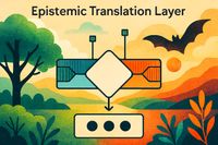
To support systematic reasoning, the framework introduces the scope, boundaries and expansion logic of a 90‑factor set, complemented by an epistemic translation layer and a formal notation for evidence chains that trace how raw data can be transformed into governance‑relevant conclusions. The resulting GEDI Ecological Structure Baseline establishes a governance‑ready foundation, clarifying its core functions, input‑output structure and epistemic boundaries, and demonstrating its application through ecological structural indicators for urban One Health contexts — including the scenario example developed for Cairo.
A complementary second framework, EO Layer – Architecture of Zoonosis Prevention and Resilience, is currently under development and will extend the present work by addressing the architectural and operational dimensions of Earth‑observation‑based zoonosis prevention.
Zoonoses rank among the most significant and at the same time most underestimated — risks of our era. They emerge where ecological, economic and social interfaces converge: in transition zones between wildlife, livestock and humans; in markets; in agricultural clusters; in coastal settlements; or at seemingly mundane contact points such as water sources, waste sites or broken fences. Often, a single spillover moment is enough to destabilize global supply chains, strain health systems and unsettle societal stability.
The core problem is that traditional surveillance systems react too late. The invisible pre‑phase — the period in which risks emerge, intensify and spread — frequently remains unmonitored. Whether animal diseases, environmental crises or social disruptions, the pattern is consistent: our societies possess mechanisms for reaction, but lack genuine resilience strategies. Many structures are reactive rather than resilient.
The reality is alarming. African Swine Fever has reached Spain — a country with more than 54 million pigs and annual exports worth around 8 billion euros. It is assumed that a single contaminated sandwich, eaten by wild boar, triggered a cascade of events: military emergency measures, import bans and the sobering realization that no vaccine exists. Such outbreaks threaten not only agriculture but also the stability of supply chains and societies.
We tend to act only when it is already too late. Early‑warning systems and edge‑zone triggers are missing in many places or are not used consistently.
My aim is to help close this gap. Through strategic concepts, I seek to contribute to the development of a more robust, multipolar early‑warning system that connects science, policy and civil society and enables preventive action. In this context, Earth Observation (EO) is not a technical add‑on but a strategic instrument: it illuminates the invisible bridges between environment, animals and humans and it can empower us not only to respond to zoonoses, but to anticipate and prevent them.
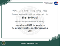
My participation in NASA’s ARSET training was a valuable opportunity to become familiar with the practical application of GEDI from a global perspective. Particularly enriching was the openness of the format, which offered insights into different approaches, questions and application contexts.
I would like to express my sincere gratitude to the ARSET team and NASA. The opportunity to take part in such an important program creates a space in which professionals from around the world can learn together, exchange experiences and develop new perspectives.
It was precisely this diversity of viewpoints that inspired me to think further and to develop my own approaches — not as an alternative, but as a complementary contribution to a landscape that is constantly evolving. Programs like ARSET make a very important global contribution: they open doors, stimulate reflection, and foster exchange
My gratitude also extends to all those around the world who dedicate themselves with great care and professional depth to the study of zoonoses, One Health, and the diverse dynamics at the human–animal–environment interface. Their work — often carried out in the background, frequently under enormously challenging conditions, and always in interdisciplinary constellations — demonstrates how essential shared learning, continuous observation, and responsible knowledge development are for our global systems. This commitment creates a quiet yet indispensable resonance space in which new approaches can emerge, and in which this framework, too, finds its place.

#Zoonoses #OneHealth #PlanetaryHealth #HealthSecurity #GlobalResilience #PreventionFirst #EarthObservation #GEDI #RemoteSensing #EcologicalStructures #EOForHealth #EarlyWarning #RiskAnticipation #ResilienceGovernance #InterfaceRisks #HumanAnimalEnvironment #InterfaceEcology #SpilloverPrevention #Biointerfaces #NASAARSET #CapacityBuilding #GlobalCollaboration #KnowledgeSharing