Geo-Resilience Framework
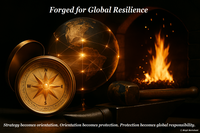
The strategic framework for global resilience architectures - Anticipate. Structure. Govern.
In a world increasingly shaped by dynamic and complex transformation processes, the need arises for new forms of forward-looking, context-sensitive and technologically precise governance. The Geo-Resilience Framework is evolving as a platform for strategic system architectures designed to accompany complex challenges across space and time in a structured manner – with the aim of advancing cross-sectoral processes in areas such as environmental change, natural events, health care, infrastructure development, the management of pollutants and legacy contaminants, the prevention and response to biological risks and the restoration of societal functions in conflict-affected regions. These processes are not merely to be supported reactively, but to be developed in a structurally formative and future-oriented way.
Internationally compatible frameworks will emerge here, enabling the integration of spatio-temporal data with reflective decision-making logics.
The concepts developed within this platform open up new possibility spaces for the systemic and operational linking of knowledge, technology and context-sensitive action.
The Geo-Resilience Framework is intended to invite:
- The sharing, further development and translation of strategic thinking into lived operational depth
- Collaborative engagement in an architecture that not only accompanies transformation, but meaningfully structures it and contributes to strengthening societal resilience
Geo-Resilience Compass – Navigating Strategic Resilience
Why we need a Geo-Resilience Compass
In a world characterized by multiple, overlapping crises — environmental change, biological risks, infrastructural vulnerability, social fragmentation — we often lack not data, but structural orientation. The Geo-Resilience Compass is intended to provide this orientation i.e., not as a map, but as a strategic navigation tool that systematically links knowledge, technology and context-sensitive control.
The compass is designed to translate abstract topics into visually tangible directions and highlight where resilience can develop and how it needs to be linked operationally.
The compass aims to translate abstract topics into visually tangible directions and highlight where resilience can emerge and how it must be operationally linked. The environment, health, infrastructure, and society are not separate silos. The compass aims to show us their systemic connection and enable more targeted navigation through spatiotemporal challenges.
The compass is not a static symbol, but an open system.
In international and global contexts, symbols are needed that do not dominate but connect.
Center - Resilience Backbone
- Reflexive decision-making logic
- adaptive coordination mechanisms
- Trust, participation and semantic openness
- Integration of anticipation, structuring and implementation
North - Environmental Change & Legacy Contaminants
- Shifts in ecosystems and land use
- Management of pollutants and legacy contamination
- Soil, water and air resilience
- Early indicators of environmental stress
Northeast (NE) - Early Warning Systems & Risk Detection
- Integration of Earth observation, sensors, and real-time data
- Pattern recognition for natural hazards and health risks
- Scenario development and anticipatory planning
- Cross-sectoral data logic
East - Health & Biological risks
- Zoonoses, pandemics, and microbiological risks
- Stabilization of supply and care systems
- Prevention and monitoring
- Interfaces between environmental and health systems
Southeast (SE) - Coordinated Care & Adaptive Infrastructure
- Mobile supply units as an expression of closeness and care
- Logistics as a connection
- EO as support for local self-organization
- Planning as facilitation
South - Infrastructure & Restoration
- Protection and reconstruction of critical infrastructure
- Planning of resilience zones
- Adaptation to natural hazards (floods, heavy rainfall, earthquakes)
- Technical robustness and restart strategies
Southwest (SW) - Local Continuity & Community Reconnection
- Restoration of education, culture and local knowledge systems
- Planning with social sensitivity
- Inclusion of local structures and networks
- Support for collective recovery
West - Societal Adaptation & Stabilization
- Local adaptation strategies and social resilience
- Stabilization of supply, communication and everyday systems
- Promotion of cohesion and functional self-organization
Northwest (NW) - System Coherence & Communication Architectures
- Alignment of technical and organizational interfaces
- Design of robust information flows
- Navigating uncertainty and ambiguity
- Semantic connectivity across diverse contexts
Bio-Resilience Engine
- PK-Winter-Matrix (17-8-Axis-Model)
- Pesticide (17/8)
This contribution was authored by Birgit Bortoluzzi, strategic architect and certified Graduate Disaster Manager. The content reflects original interdisciplinary synthesis developed within the framework of the Geo-Resilience Initiative.